
biru’ na zayzyuwaw:Ireland (MODIS).jpg
Spzyang puqing balay na Tang’an (1,600 × 2,200 qqblayqan zzyangay, zayzyuwaw biru’ na sspngan kinkrahu’: 2.69 MB, gluw na mmntnaq MIME: image/jpeg)
Lalu’ na spzyang bbiru’ su’
| Minblaq kmal |
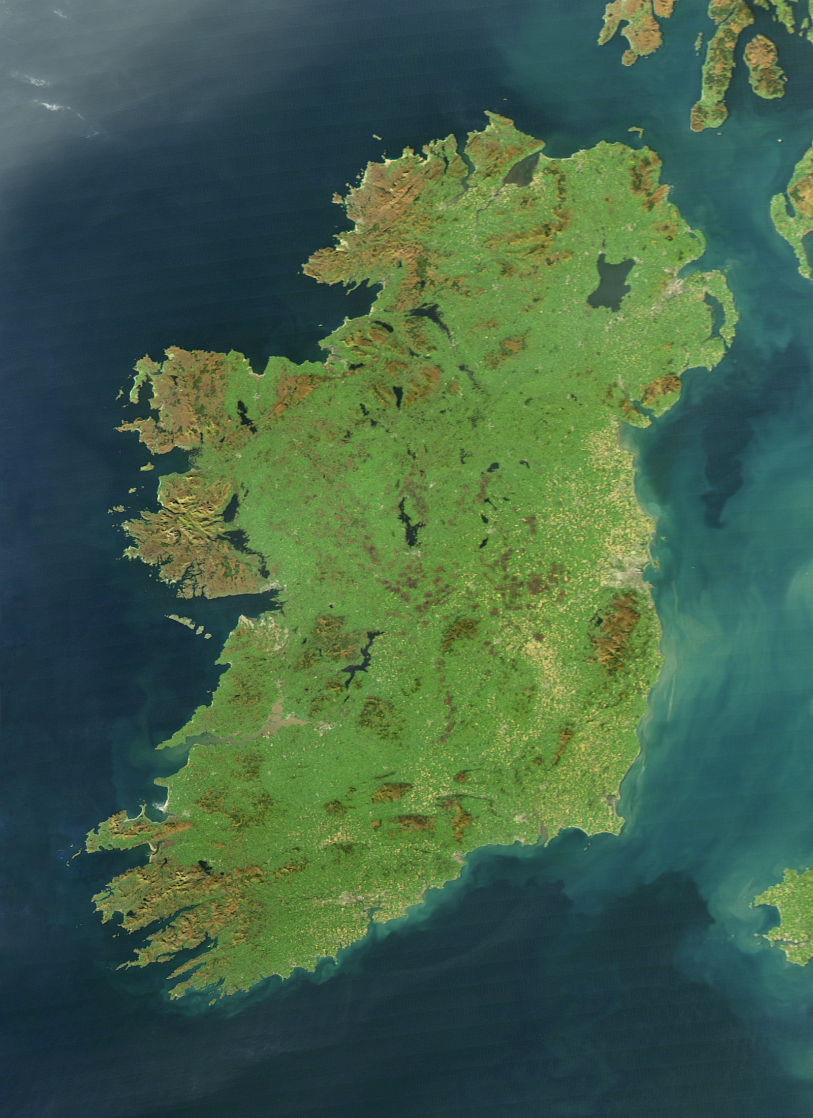
English: It is easy to see from this true-colour image why Ireland is called the Emerald Isle. Intense green vegetation, primarily grassland, covers most of the country except for the exposed rock on mountaintops. Ireland owes its greenness to moderate temperatures and moist air. The Atlantic Ocean, particularly the warm currents in the North Atlantic Drift, gives the country a more temperate climate than most others at the same latitude. |
| ryax | |
| tkhulan | NASA Earth Observatory |
| mniru’ | Jeff Schmaltz |
| Ubuy gluw bniru’ na bzinah |
|
.jpg)
The cloud-free view shown here is extremely rare. The Moderate Resolution Imaging Spectroradiometer (MODIS) on NASA’s Aqua satellite captured the image on October 11, 2010, a time of year when Irish weather alternates between rainstorms from the west and cool, dry weather brought by high pressure systems known as anticyclones.
Biru’ na gaga’ nqu snwayal hmriq sa kinri’
| 本作品由NASA創作,屬於公有領域。根據NASA的版權政策:“NASA的創作除非另有聲明否則不受版權保護。”(參見:Template:PD-USGov/zh,NASA版權政策或JPL圖像使用政策) | ||
 |
警告:
|
Bniru’ naha’ sa sinr’zyutan na biru’
Pphtan ryax/zikang sa kkita’ squw kinblayan biru’ na zayzyuwaw.
| ryax/zikang | Swotu’ | Sspngan kinkrahu’ | kwara’ ka cyux mbing ka qutux qutux ngasal. | Tnwang smbbaq miru’ | |
|---|---|---|---|---|---|
| misuw qaniy | 2017年8月4日 (Tay zmagal ryax qutux hngawan) 20:14 | | 1,600 × 2,200(2.69 MB) | Blight55 | quality degraded from original, taken from original |
| 2017年4月21日 (Tay zmagal ryax qutux hngawan) 18:04 |  | 1,600 × 2,200(1.16 MB) | Blight55 | No borders in space, removed clouds | |
| 2011年12月26日 (Ringan qutux hngawan) 04:18 |  | 1,600 × 2,200(532 KB) | Tóraí | Less sever colour adjustments from original. | |
| 2011年12月13日 (Tay sazing ryax qutux hngawan) 21:41 |  | 1,512 × 1,928(800 KB) | Soerfm | Brightness, crop | |
| 2011年3月17日 (Tay spayat ryax qutux hngawan) 18:22 |  | 1,600 × 2,200(409 KB) | Originalwana | {{Information |Description ={{en|1=It is easy to see from this true-colour image why Ireland is called the Emerald Isle. Intense green vegetation, primarily grassland, covers most of the country except for the exposed rock on mountaintops. Ireland |
Pptzyuwaw na sinr’zyut biru’
Nyux sbiru’ tay hugal ka qutux zngazyansp’ubuy sa biru’ qaniy.
Pintzyuwaw kwara’ cinbwanan ka binrwan biru’ qaniy
Kwara’ nyux kyahu’ ka wiki bzinah ga nyux mtzyuwaw ga Tang’an qaniy:
- af.wikipedia.org na zyuwaw na pincyuwagan
- ar.wikipedia.org na zyuwaw na pincyuwagan
- arz.wikipedia.org na zyuwaw na pincyuwagan
- ast.wikipedia.org na zyuwaw na pincyuwagan
- az.wikipedia.org na zyuwaw na pincyuwagan
- be-tarask.wikipedia.org na zyuwaw na pincyuwagan
- br.wikipedia.org na zyuwaw na pincyuwagan
- ca.wikipedia.org na zyuwaw na pincyuwagan
- ceb.wikipedia.org na zyuwaw na pincyuwagan
- cy.wikipedia.org na zyuwaw na pincyuwagan
- da.wikipedia.org na zyuwaw na pincyuwagan
- de.wikipedia.org na zyuwaw na pincyuwagan
- el.wikipedia.org na zyuwaw na pincyuwagan
- en.wikipedia.org na zyuwaw na pincyuwagan
- Ireland
- Geography of Ireland
- Gaelic Athletic Association
- Irish Rugby Football Union
- Swim Ireland
- Sport in Ireland
- United Ireland
- Rugby League Ireland
- Irish Real Tennis Association
- Irish Sailing Association
- Portal:Europe
- Hurlingham Polo Association
- List of fractals by Hausdorff dimension
- Cricket Ireland
- Australian Rules Football League of Ireland
- Baseball in Ireland
- Irish Ice Hockey Association
- Baseball Ireland
- Fencing Ireland
- Olympic Federation of Ireland
- Ladies' Gaelic Football Association
- Softball in Ireland
- Pitch and Putt Union of Ireland
- Cycling Ireland
- Horse Sport Ireland
- Basketball Ireland
- Tennis Ireland
- Boxing Union of Ireland
- Parachute Association of Ireland
- Football Association of Ireland
’nblaq mita’ quw biru’ na sslyan kwara’ zayzyuwaw pzyux na’ zyuwaw na kwara’ kin na kaykay’ ana’ inu’.
.jpg)
.jpg)